Nestled on the border between Canada and the US is Lake Erie, one of the five Great Lakes of North America. For the 2024 Great North American Solar Eclipse which occurred on April 8th, my partner and I drove down to the lake near Fort Erie, ON, to watch the event unfold in the path of totality. Despite being an overcast day, the region descended into darkness for about 3 minutes in the middle of the afternoon. It was a fantastic experience and definitely worth the drive from Guelph.
Planning this trip using satellite images uncovered a strange phenomenon however, a strange spiral emerging up from the bottom of Lake Erie.
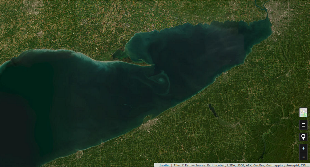
For context, the land at the top of the picture is Ontario, and on the bottom are the states of Pennsylvania on the left and New York on the right. The border between the two states cuts between the city on the edge of the lake (Erie, Pennsylvania), and the wee Chautauqua Lake to the right of the spiral.
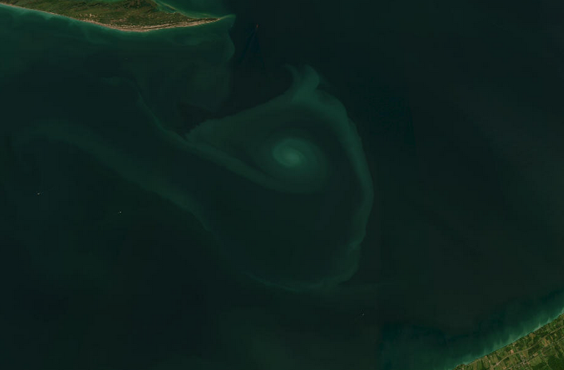
Weird eh?
Although I haven’t spent a tremendous amount of time trying to figure out what caused this, the search terms which come to mind have yielded neither answers nor leads. I have no background in any kind of Earth studies and am out of my depth on approaching this mystery, so I can imagine it will be quite a while before I uncover more information about this strange formation.
The map service which uncovered this phenomena is not Google maps, but a map plugin for Nextcloud which seems to pull data from Esri, an organization which specializes in geographic information system software. The spiral does not appear in satellite view on Google Maps nor the Google Earth web app, at any level of zoom.
I will update this page if I find any leads or information, but it may take a while before I find some answers to my questions.
/back/